GIS Services
Planview USL supports your location based infrastructure asset management strategy with a range of options from subscription services, to fully hosted geospatial applications and GIS data migrations.
Our GIS methodology is to continuously improve the integrity of our customer’s data, leading to optimized network planning, enhanced network performance and elevated customer experience outcomes.
GPS DATA COLLECTION SERVICES
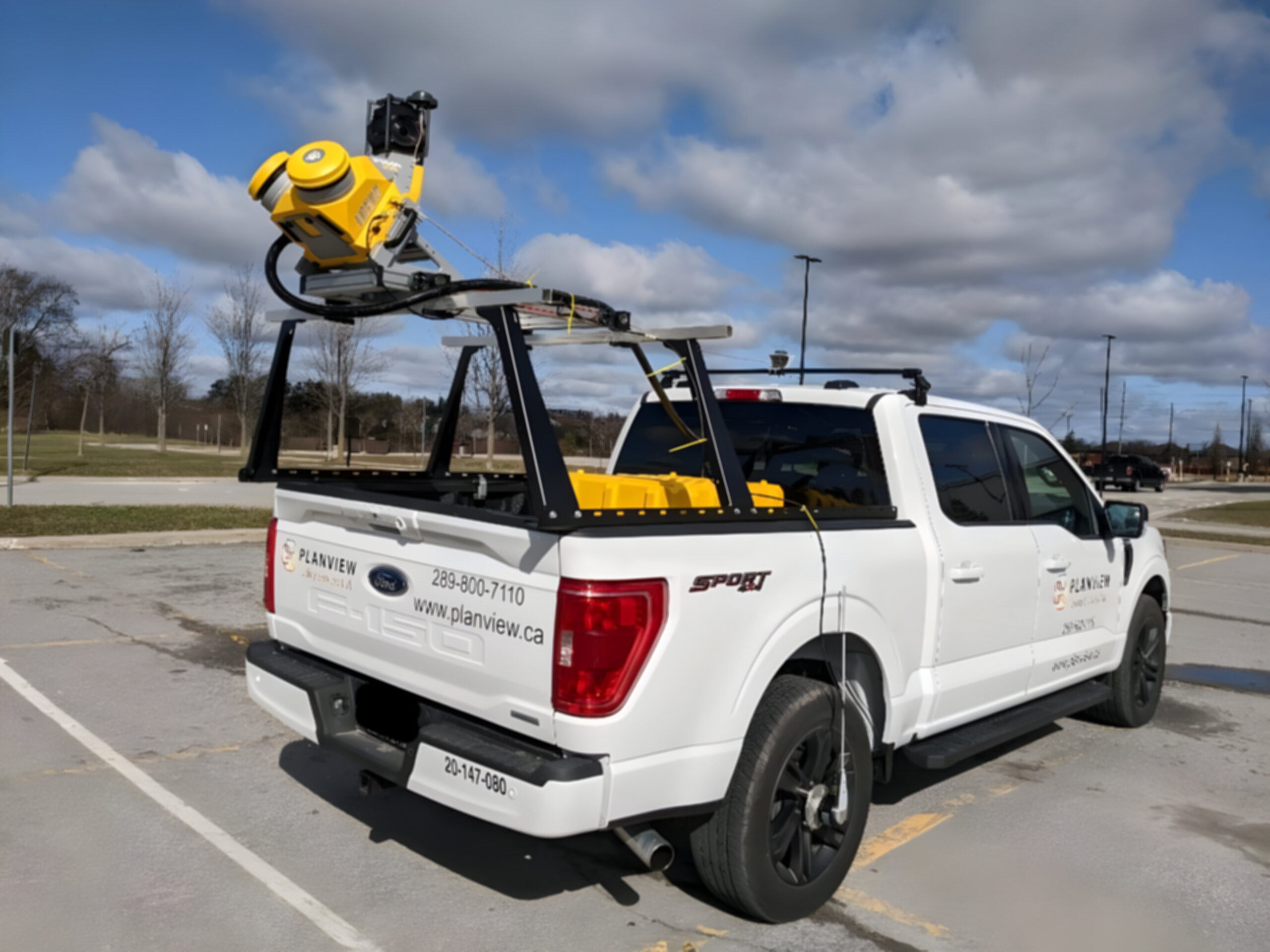
- Vehicle based mobile LiDAR. Collection and Extraction services.
- 1View.works. Enable remote teams to access accurate and measurable 3D point cloud and 360 degree street level imagery for preliminary design purposes, visual inspections and asset management.
- Landbase-as-a-Service. Feature rich land base datasets extracted from our mobile LIDAR in any GIS format.
GIS-AS-A-SERVICE
- Access a team of GIS experts to manage your evolving GIS data.
- Securely hosted GIS environment.
- Access your data remotely, from any device.
- Enable your field resources to contribute to the accuracy of your data with easy to use mobile apps.
- Varying levels of service from fully managed and fully hosted to ongoing specialized expertise with specific GIS requirements.
GIS MIGRATIONS
- Expert geospatial systems professionals Specialized expertise in electric, gas, telecommunications, water and wastewater data.
- ESRI Silver Partner Certified
- ESRI Utility Network Model
- Data modelling, migration and integration
CUSTOMIZED GIS APPLICATIONS
Tailored data collection for the creation of customized applications and dashboards specific to your geospatial requirements using arcGIS Online, Experience Builder, Web App Builder, FME Cloud, Vertigis Web and Workflow, Survey 123 and javascript API for arcGIS Online.